


James Well
James Well, formerly an Aboriginal watering place, was named after William Wearne JAMES who owned a farm nearby when other settlers got their water from.
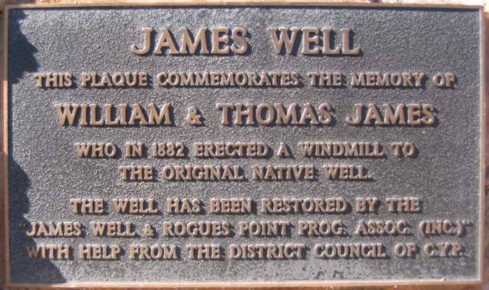
Plague on the Well
Surveyors in the Hundred of Muloowurtie were:
- W. Baker - Sections 1 and 2 (1846)
- W. Earle - Sections 5, 7-38 (1877), Sections 59-52 (1878)
- N.W. Pethick - Sections 53-78 and 80-85 (1878)
- A. Kershaw - Sections 3 and 4 (1881)
|
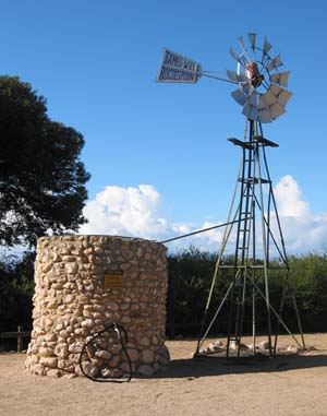
The Well and Windmill on James Well Road | The table below shows the land purchased by Wiliam Wearne JAMES that became James Well.
Much of the Hundred of Muloowurtie was covered in scrub. The following Sections were taken up as Scrub Leases by William Wearne JAMES and Thomas JAMES from 1 October 1881 for a term of twenty-one years
|
Click here to see the Muloowurtie map to see the Sections highlighted that William & Thomas JAMES purchased and leased.